- You are here:
- Home »
- GPS Products »
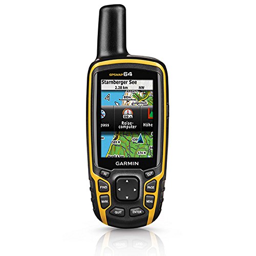
- Garmin GPSMAP 64 Worldwide with High-Sensitivity GPS and GLONASS Receiver
Garmin GPSMAP 64 Worldwide with High-Sensitivity GPS and GLONASS Receiver


Rugged, Full-featured Handheld with GPS and GLONASS Combined
2.6″ sunlight-readable color screen High-sensitivity GPS and GLONASS receiver with quad helix antenna 4 GB of internal memory and a microSD™ card slot 250,000 preloaded caches for paperless caching from Geocaching.com 
GPSMAP 64 features a 2.6″ sunlight-readable color screen that supports BirdsEye Satellite Imagery (subscription required) and Garmin Custom Maps. Rugged and waterproof, GPSMAP 64 uses a quad helix antenna for superior reception.
Explore the Terrain
GPSMAP 64 comes with a built-in worldwide basemap with shaded relief so you can navigate anywhere with ease. With photo navigation, you can download geotagged pictures from the Internet and navigate to them.
Keep Your Fix
With its quad helix antenna and high-sensitivity, GPS and GLONASS, receiver, GPSMAP 64 locates your position quickly and precisely and maintains its location even in heavy cover and deep canyons. The advantage is clear — whether you’re in deep woods or just near tall buildings and trees, you can count on GPSMAP 64 to help you find your way when you need it the most.
Add Maps
Adding more maps to GPSMAP 64 is easy with our array of detailed topographic, marine and road maps. With 4 GB of onboard memory and microSD card slot, you can conveniently download TOPO 24K and 100K maps and hit the trail, plug in BlueChart® g2 preloaded cards for a great day on the water or City Navigator NT® map data for turn-by-turn routing on roads (see maps tab for compatibility). GPSMAP 64 also supports BirdsEye Satellite Imagery (subscription required) that lets you load satellite images onto your device and integrate them with your maps. In addition, the 64 is compatible with Custom Maps, a map format that allows you to transform paper and electronic maps easily into downloadable maps for your device, for free.
Find Fun
GPSMAP 64 supports paperless geocaching with 250,000 preloaded caches with hints and descriptions from Geocaching.com, and has a 16-hour battery life. By going paperless, you’re not only helping the environment, but also improving efficiency. GPSMAP 64 stores and displays key information, including location, terrain, difficulty, hints and descriptions, which means there’s no more manually entering coordinates and paper printouts! Slim and lightweight, 64 is the perfect companion for all your outdoor pursuits.
Plan Your Next Trip
Take charge of your next adventure with BaseCamp™, software that lets you view and organize maps, waypoints, routes and tracks. This free trip-planning software even allows you to create Garmin Adventures that you can share with friends, family or fellow explorers. BaseCamp displays topographic map data in 2-D or 3-D on your computer screen, including contour lines and elevation profiles. It also can transfer an unlimited amount of satellite images to your device when paired with a BirdsEye Satellite Imagery subscription.
Product Features
- Sunlight-Readable 2.6″ color display
- Expanded Internal Memory 4GB
- DUAL BATTERY SYSTEM Use with 2 traditional AA batteries, or the optional rechargeable NiMH battery pack that can be charged while inside the device
- 16 hour battery life
"Click Here!!! to get the best picture, get the best deal, lowest price and more detailed differences and similarities of the product as well as some more important information affecting your purchasing decision."Click Here
Session expired
Please log in again. The login page will open in a new tab. After logging in you can close it and return to this page.

Highly Accurate Been using this unit for over a month. The gps is highly accurate, contrary to what a few other reviews said. The tracks function does wander slightly while standing still but it’s made for people who are on the move. I loaded both purchased and free maps to both the internal hard drive and the SD card without issues. I also created some custom maps for use on a trip. Text notifications work instantly and I like the button versus the touch screen especially in a cold climate for hunting. The screen is small but amazing in both low light and bright light conditions. The battery life is also good with plenty of settings for your needs. I love this unit.4/21/14 Just got back from Saint John, VI. Took my GPSMAP 64 down Reef Bay Trail to Lamesur Trail, with dense cover, all the way to the tip of the Island in the SE. The hike was about 8-9 miles. I then hitchhiked back to our resort and left my gps running. The round trip totaled about 20 miles of mountainous,…
I like a few things better on this compared to my … 0
Just what I needed! In addition to being a nature lover, I am in the Civil Air Patrol (US Air Force Aux), who does inland search and rescue (SAR). I use this GPS for pleasure hiking, SAR, and have also used this in an airplane doing aerial photo missions. It was invaluable to have. Even though the aircraft was equipped with a Garmin G1000 GPS, it was very helpful to have my handheld with pre-progammed waypoint to guide the pilot to the target to take pictures. We were near a military no-fly area, so the pilot had to have the G1000 zoomed out to see the surounding airspace, yet with my 64s, I was able to see the 24k topo in great detail with downloaded birdseye to find my photo targets quickly.I have used this unit on several hikes and it has been very helpful to guage breaks, and where to stop for the night based on known camping waypoints. Without it on one hike I would have kept going, only to find no suitable camping sites and would have had to backtrack. I have also thoroughly…